Dry Stone Conservancy Map
Links


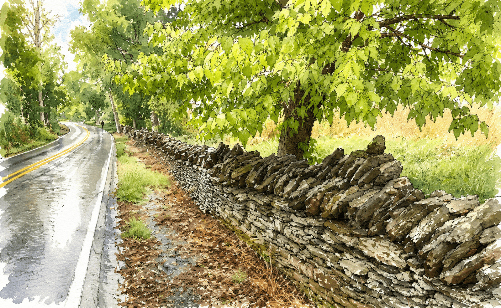
If there are ever sermons in stones, it is when they are built into a stone wall, turning your hindrances into helps, shielding your crops behind the obstacles to your husbandry.
The limestone country of central Kentucky's Bluegrass region is home to thousands of dry stone structures: field walls, cemetery enclosures, arched bridges, and farmstead foundations built without mortar. Despite appearances, these are not simple constructions. "Close examination reveals that the fences are complex and employ in subtle ways the physics of friction, angle, and gravity to maintain cohesion and stance."[1] They are cultural artifacts as much as agricultural infrastructure, shaped by the region's geology, the economics of antebellum and post-war Kentucky, and the craft knowledge passed (or, increasingly, not passed) from one generation of masons to the next.
The oral traditions of fence masonry are "largely obscured."[1] The Dry Stone Conservancy has been working to close that gap by systematically documenting the location, condition, age, and restoration history of dry stone structures across the eastern United States. What they needed was a structured way to collect that data in the field, and a tool to make sense of it.
What I Built
I came on as a technical partner and owned the project end to end: survey design, data pipeline, and front end.
The survey. I designed the field survey from scratch in KoboToolbox. Working with DSC staff to define what the data needed to capture, the form collects structure location (GPS, address, or general description), type, condition, stone material, age range, restoration history, mason attribution, and up to five photos per submission. Privacy was a first-class design constraint from the start: submitters choose whether their GPS coordinates are published exactly, generalized to a ~5-mile radius, or withheld entirely. That decision flows downstream through every layer of the system.
The pipeline. A TypeScript script fetches new submissions from KoboToolbox's API since the last run, downloads submitted photos, normalizes the raw survey JSON, and writes each entry to the repo as a structured file. An incremental manifest prevents redundant re-downloads. At build time, a prebuild script compiles all entries into a single walls.json. No database. No runtime queries.
The front end. The app has two primary views.
Wall Finder is a photo gallery paired with a Leaflet map. Filters let you narrow by state, stone type, condition, structure type, and project type (historic, restoration, new build). Each card links to a detail view with the full submission record, partner attribution, and all uploaded photos.
Story Map is a five-chapter scrollytelling narrative driven by Framer Motion. It moves from a national overview through the limestone-lined lanes of the Kentucky Bluegrass, back to the oldest pre-1800 structures, forward to active DSC restoration projects, and out to the expanding survey beyond Kentucky. Each chapter filters the map to the relevant wall subset, zooms to the right region, and highlights a featured structure with a pull quote from the submission record.
Submissions can be attributed to a partner organization, including the National Park Service, Olmsted Parks Conservancy, Maker's Mark, and the Kentucky Transportation Cabinet. Partner logos appear on wall detail cards when attribution is on record.